i3GEO.Interface.ATUAL = "openlayers";i3GEO.Interface.openlayers.googleLike = true;i3GeoUrl = i3GEO.util.protocolo() + "://" + window.location.host + "/i3geo";i3GEO.janela.ativaAlerta();
(function() {
if(typeof ol != "undefined" && i3GEO.Interface.openlayers.googleLike === false){
var eng = new ol.layer.Tile(
{
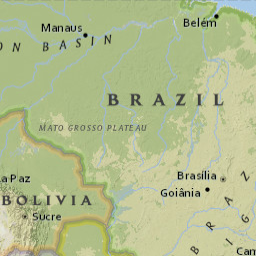
title : "ESRI National Geographic",
visible : true,
isBaseLayer : true,
name : "eng",
preview : " ",
source : new ol.source.TileArcGISRest(
{
url : "http://server.arcgisonline.com/ArcGIS/rest/services/NatGeo_World_Map/MapServer",
attributions : [ new ol.Attribution(
{
html : 'Tiles © ArcGIS'
}) ]
})
});
var oce = new ol.layer.Tile(
{
title : "ESRI Ocean Basemap",
visible : false,
isBaseLayer : true,
name : "oce",
preview : "
 ",
source : new ol.source.TileArcGISRest(
{
url : "http://server.arcgisonline.com/ArcGIS/rest/services/Ocean_Basemap/MapServer",
attributions : [ new ol.Attribution(
{
html : 'Tiles © ArcGIS'
}) ]
})
});
var ims = new ol.layer.Tile(
{
title : "ESRI Imagery World 2D",
visible : false,
isBaseLayer : true,
name : "ims",
preview : "
 ",
source : new ol.source.TileArcGISRest(
{
url : "http://server.arcgisonline.com/ArcGIS/rest/services/ESRI_Imagery_World_2D/MapServer",
attributions : [ new ol.Attribution(
{
html : 'Tiles © ArcGIS'
}) ]
})
});
var wsm = new ol.layer.Tile(
{
title : "ESRI World Street Map",
visible : false,
isBaseLayer : true,
name : "wsm",
preview : "
 ",
source : new ol.source.TileArcGISRest(
{
url : "http://server.arcgisonline.com/ArcGIS/rest/services/ESRI_StreetMap_World_2D/MapServer",
attributions : [ new ol.Attribution(
{
html : 'Tiles © ArcGIS'
}) ]
})
});
var bra = new ol.layer.Tile(
{
title : "Base carto MMA",
visible : false,
isBaseLayer : true,
name : "bra",
preview: "
 ",
source : new ol.source.TileWMS(
{
url : "http://mapas.mma.gov.br/cgi-bin/mapserv?map=/opt/www/html/webservices/baseraster.map&",
params : {
'layers' : "baseraster",
'srs' : "EPSG:4326",
'format' : "image/png"
}
})
});
i3GEO.Interface.openlayers.LAYERSADICIONAIS = [ eng, oce, ims, wsm,
bra];
}
if(typeof ol != "undefined" && i3GEO.Interface.openlayers.googleLike === true){
var attribOSMData = 'Map Data: © OpenStreetMap contributors';
var attribMapQuestAerial = 'Map Data: © Portions Courtesy NASA/JPL-Caltech and U.S. Depart. of Agriculture, Farm Service Agency, Tiles Courtesy of MapQuest
  ';
var attribStamen = 'Map tiles by Stamen Design, under CC BY 3.0. Data by OpenStreetMap, under CC BY SA';
var osm = new ol.layer.Tile({
title : "OSM",
visible : true,
isBaseLayer : true,
name : "osm",
source: new ol.source.OSM({
attributions : [new ol.Attribution({html: attribOSMData})],
crossOrigin : "anonymous",
url : "http://tile.openstreetmap.org/{z}/{x}/{y}.png"
})
});
var maps = new ol.layer.Tile({
title : "GMAPS SAT",
visible : false,
isBaseLayer : true,
name : "maps",
source: new ol.source.TileImage({ url: 'http://mt1.google.com/vt/lyrs=s&hl=pl&&x={x}&y={y}&z={z}' })
});
i3GEO.Interface.openlayers.LAYERSADICIONAIS = [ osm,maps ];
}
})();
 ';
var attribStamen = 'Map tiles by Stamen Design, under CC BY 3.0. Data by OpenStreetMap, under CC BY SA';
var osm = new ol.layer.Tile({
title : "OSM",
visible : true,
isBaseLayer : true,
name : "osm",
source: new ol.source.OSM({
attributions : [new ol.Attribution({html: attribOSMData})],
crossOrigin : "anonymous",
url : "http://tile.openstreetmap.org/{z}/{x}/{y}.png"
})
});
var maps = new ol.layer.Tile({
title : "GMAPS SAT",
visible : false,
isBaseLayer : true,
name : "maps",
source: new ol.source.TileImage({ url: 'http://mt1.google.com/vt/lyrs=s&hl=pl&&x={x}&y={y}&z={z}' })
});
i3GEO.Interface.openlayers.LAYERSADICIONAIS = [ osm,maps ];
}
})();